• Home
  • About
  • Projects
  • More...
    • Home
    • About
    • Projects
  • Your Cart
  • Get Started
Get Started
Interactive Tableau Map

Tableau for Spatial Analytics

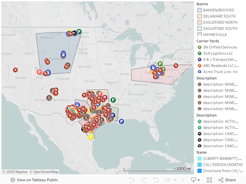
For this project, I sourced multiple geospatial datasets on frac sand distribution for oil and gas operations. I aggregated mine, transload yard, and regional basin datasets with location coordinates to render an interactive map using Tableau.

Frac Sand Supply Chain Map

Tech Stack: Tableau / Data Analytics Software / Data Aggregation / Embedded Analytics
n8n Lead Generator Demo

n8n Lead Generator Live Demo

This workflow generates leads for Solaris Energy and assigns intelligent recommendations to each lead based on multiple factors including lead score, industry type, company size, and area of interest. The system analyzes these data points to determine the best action plan for each prospect.

Key Features:

  • Leads generated with complete contact info, industries, and interests
  • Includes priority assignments with next steps
  • Calculates potential revenue per lead
  • Processes in real-time via webhook triggers using embedded JSON

Click button to generate leads:

Generated Leads

Tech Stack: n8n Automation / Webhook Integration / REST API

© All rights reserved.